


 32 / 36

28
DELTARES, September 2016
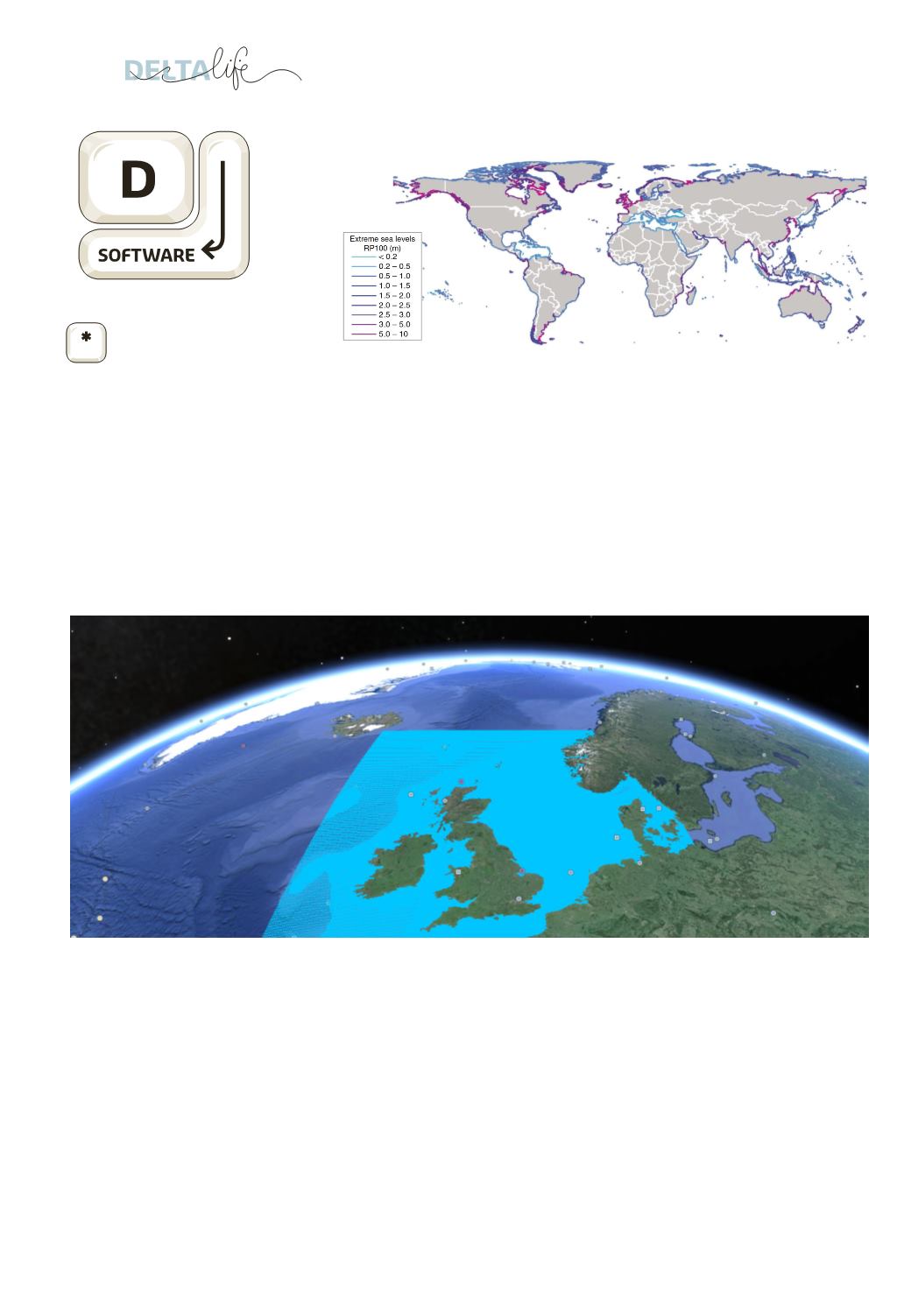
Extreme sea water levels caused by tidal waves and spring tides can
have devastating social effects. Approximately 600 million people live
around the world in low-lying coastal areas where the risk is highest.
Deltares and the VU-University of Amsterdam developed a map of
the world that shows extreme sea levels for all coastlines. One of the
main factors underlying this study was the launch of Delft 3D software
that includes the option of raising model resolutions locally (Delft3D
Flexible Mesh). As a result, the hydrodynamic model delivers uniquely
high resolutions for coastal areas while making extremely efficient
calculations at the same time.
The new dataset includes extreme water levels that may occur once
every hundred years. Until now, only regional data have been available
about these water levels. They were not yet available at the global
scale.
The researchers’ article about the dataset was published in Nature
Communications on 27 June.
Global map shows extreme seawater levels
North Sea webinar seen in 71 countries
The webinar ‘Hydrodynamic modeling on the Northwest European Shelf
and North Sea: new opportunities with Delft3D Flexible Mesh’ took place
on Monday, 20 June. 483 participants from 71 countries had registered
to follow the presentation online without being physically present.
This is a new record. The participants came from a wide range of
countries including Australia, Brazil, Canada, China, Germany, France,
Indonesia, Singapore, United Arab Emirates, United Kingdom, Vietnam,
USA and South Africa.
In the webinar, Firmijn Zijl focused on the ongoing development and
improvement in the operational tidal models for the Northwest-European
Continental Shelf – the section of the continent that is under water –
and in particular on the North Sea and the adjoining shallow seas and
estuaries (wide river outlets created by tidal flows).
In the Netherlands, accurate predictions of water levels on the coast
are crucial because large areas of the country are below sea level. The
importance of precise and accurate warnings is even more critical due to
the movable barriers such as the Eastern Scheldt and Maeslant barriers.
That is because the decision to close these barriers has to be taken in
time, but only when it is strictly necessary.
For more information:
www.deltares.nl/en/webinars/