


 27 / 36

DELTARES, September 2016
23
FROM SATELLITE IMAGE
TOWATER MAPS
S
atellite images contain a lot of information
and they are a gold mine for researchers.
The only drawback: there is so much
information that you can't do anything
with it using a standard computer.
Researcher Gennadii Donchyts knows all about
this. He needed satellite images for his doctorate
study of interactive surface models.
He turned to Google Earth Engine, a platform that
provides access to petabytes of satellite images.
One petabyte is the equivalent of the amount of
information you can store in a 1.8-kilometre-high
tower of DVDs. Without sleeves. Google Earth
Engine also provides the computer capacity to
make calculations with these data.
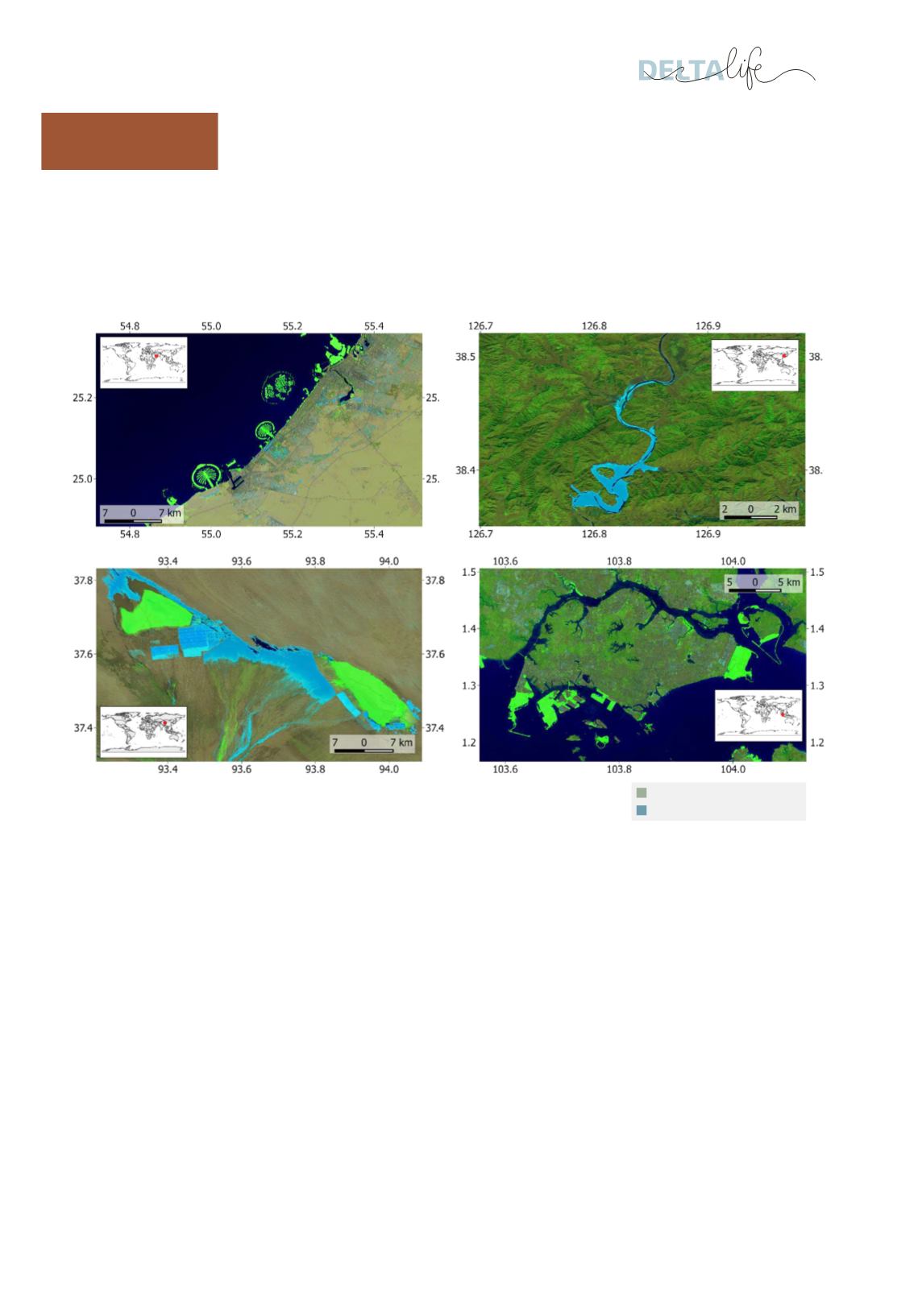
Gennadii Donchyts developed a calculation
method that combines elevation measurements
with other satellite data to develop better water
maps. The Deltares Aqua Monitor website, which
was launched in October, uses these new water
maps to show how coasts and waterways move
and change in the course of the time, and increase
or decrease in size. This is all done on the basis of
objective, free, high-resolution information that
cannot be found in any other archive or dataset.
There is now a community where researchers
share calculation methods of this kind. ‘In that
way, knowledge becomes more widely available
and experience is shared with the community and
with Google, too,’ explains Gennadii. ‘Google can
work with big data but they lack water expertise.’
There are benefits in the other direction as well.
For example, the elevation model is no longer
accurate in some places on the map. Gennadii has
already identified a number of locations using his
calculation method and suggested corrections.
That is useful for Google.
More information:
gennadii.donchyts@deltares.nlKNOWLEDGE
INOPERATION
Alliance between Deltares and industry produces innovative techniques
and creates newmarket opportunities for business.
Water transformed into land
Land transformed into water