


 4 / 36

4
DELTARES, FEBRUARY 2015
DELTARES
IN BRIEF
FASTER PICTURE OF
COASTAL CHANGES
WITH SATELLITE IMAGES
MAJOR URBAN
CHALLENGES REQUIRE
INTERDISCIPLINARY
APPROACH
L
ed by Deltares, the Adaptive
Circular Cities project has brought
together several leading Dutch
research institutes (TNO, DLO
and ECN). The aim was to come up with
innovative solutions to major urban
challenges by identifying technologies
and planning concepts that contribute
to climate change mitigation, climate
adaptation and the sustainable use
of resources. During the preparations
for the project, it immediately became
clear that the objectives could only be
achieved by establishing interdisciplinary
teams. That is why experiments with
far-reaching cross-sectoral collaboration
between investigators and with stake-
holders were an important element in the
project. The final results can be found on
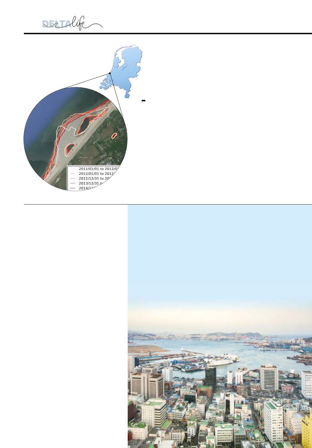
www.adaptivecircularcities.com .Deltares can use satellite images to analyse morphological
trends such as changing coastlines, sandbanks and salt marshes
almost anywhere in the world. Tools that detect these trends
automatically help to quickly establish a picture of the dynamics
in a project area. With the ever-sharper resolutions of satellite
images, more and more details are expected to become visible
in the future, improving the quality of studies and consultancy,
even in areas where few data are available.
TACKLING KOREAN
COASTAL EROSION
Deltares is working with the Korean Institute of Ocean and Technology
to tackle coastal erosion. The work is needed because increasingly
fundamental problems with erosion have been emerging since the
1970s, among other things due to the extension of ports without
integrated plans for coastal management. South Korea does not
have the right resources and knowledge to manage these problems
adequately. Deltares will therefore be helping to improve soware
and to establish a standard model so the coast can be studied
properly in the future. Deltares is working closely with Korean
specialists so that they can use with the soware independently.
PHOTO: ADOBE STOCK