


 14 / 36

Adapt river distribution
(more to Ijsel) or large
green rivers
Room for the river
actions. Side-channels,
floodplain excavation,
Embankment widening
Dike raising
Current situation incl.
planned actions
Delta dikes
Flood-proof urban areas
Design discharge m3/s
Time in a scenario with a small climate change
Time in a scenario with a large climate change
Transfer station to new policy actions
Adaptation tipping point: policy action terminus
Adaptation Pathway
First layer of Safety concept
Second layer of Safety concept
16.000
17.000
18.000
19.000 20.000
2050
2100
2050
2100
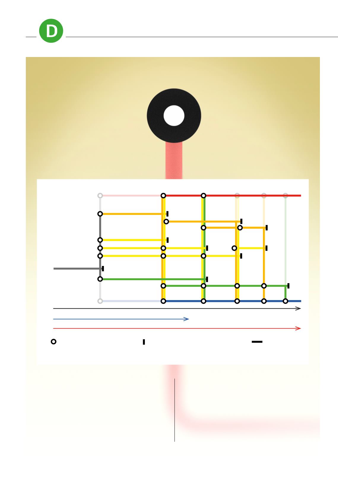
Because traditional planning practices don’t
work when the future is highly uncertain, Deltares
developed climate adaptation pathways. The
most striking element in our consultancy work is
the ‘Underground map’ showing those different
pathways. Each path refers to an interrelated
series of policy changes and investments.
Depending on the developments - objectives
may not be achieved or population growth and
climate change may be faster or slower than
anticipated - it may be decided to switch to a
different pathway or to follow several pathways
at the same time. The points at which decisions
of this kind have to be taken are referred to as
‘transfer stations’. Decisions are taken on the
basis of pre-agreed indicators. Sound, independent
monitoring is an important part of working with
climate adaptation pathways.
READY FOR CLIMATE CHANGE WITH ‘UNDERGROUND MAP’
14
DOSSIER
CLIMATE ADAPTATION