


 4 / 36

4
DELTARES, SEPTEMBER 2015
MAKING SAVINGS
ON DIKE UPGRADES
WITH MORE PRECISE
MEASUREMENTS
A better understanding of the
strength of the peat below dikes
could make it possible to reduce
costs and take less drastic action
when strengthening dikes. To
achieve this, Deltares has devised
an improved calculation and design
method for dikes on peat on the basis
of field trials. We teamed up with
the Hoogheemraadschap Hollands
Noorderkwartier water authority and
Rijkswaterstaat on this project. The
Markermeer Dikes project team is
working hard on the implementation
of the approach for the design of the
Markermeer dikes.
SATELLITE DATA TO IMPROVE
DRAIN MANAGEMENT
Drains in the soft soil of delta
cities can subside, and that can
prevent the removal of waste
water. And the pipes can also get
blocked when they crack. However,
the precise measurement of
subsidence in entire cities is
very expensive using traditional
methods. Satellites provide a
solution. From space, measure
ments that are precise to within
a millimetre can show how
quickly streets and buildings
are subsiding. Because of our
subsurface expertise, Deltares
can use data about street-level
subsidence to determine what is
happening to the drains several
metres below. We can also predict
future subsidence. Deltares
works closely with SkyGeo, the
organisation responsible for the
actual measurements, and we
expect this satellite technology to
be available soon for agencies that
manage drains.
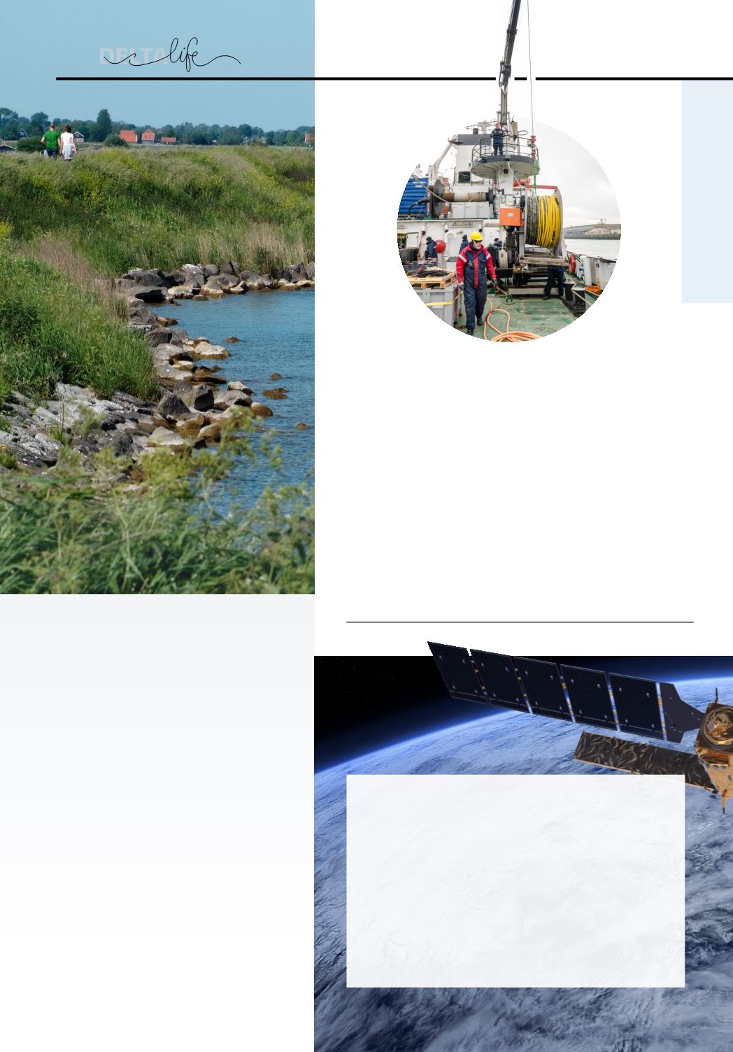
FOR MAPPING THE SEABED
There are many archaeological treasures on the seabed. But where? And how
can you study them? To determine the most suitable geophysical techniques
for conducting exploratory archaeological surveys out at sea and near the
coastline, Deltares has conducted various types of seismic measurements,
making it possible to map out archaeological hot spots. In collaboration
with the University of Ghent, two research vessels, the Belgica and Simon
Stevin of the Flanders Marine Institute, have sailed out to conduct the survey.
The thinking is that the data will provide a more complete picture of the
structure of the subsurface. The results will also be important for, among
others, dredging companies looking for sand extraction sites, and they will
provide us with more information about, and an improved insight into, future
construction projects out at sea and near the coastline.
NEWMEASUREMENT
TECHNIQUES